Perhentian Islands map: beaches on Kecil and Besar
Interactive street map of the places in this guide. It loads when you scroll here; every place is also in the numbered list below.
Street map of the places in this guide, numbered as in the list below. Tap a pin for Google Maps and directions.
Pins at each place's Google Maps location.
Street map: map data © OpenStreetMap contributors; tiles by OpenFreeMap.
Attractions
- Long Beach Google Maps
- Coral Bay Google Maps
- Masjid Ar-Rahman Google Maps
- Flora Bay Beach Google Maps
- Windmill Hill Google Maps
- Shark Point Google Maps
- Lata Air Berani Google Maps
- Jungle Trekking Cross-Island Trail Google Maps
- Teluk Keke Google Maps
- Rainforest Beach Google Maps
- Turtle Beach Google Maps
- Romantic Beach Google Maps
- D'Lagoon Beach Google Maps
Places to eat and drink
- Panorama Chalet Google Maps
- Daniela Cafe Google Maps
- Adawiyah cafe long beach Google Maps
- Monkey Hut Cafe & Bed Google Maps
- A’da Cafe Long Beach Google Maps
- Mimie's Shop Google Maps
- OhLaLa Divers Google Maps
- Santai Restaurant Google Maps
- Ombak Cafe Google Maps
- Rose and Sunset Google Maps
- Ocean Boys Cafe Google Maps
- Yatie Kitchen (Pulau Perhentian Island) Google Maps
- Maris at Perhentian Google Maps
- Amanda Cafe Google Maps
- Azilla cafe Google Maps
- Warung Pak Jokong Google Maps
- The Barat Perhentian Google Maps
- Phim Cafe Google Maps
- Hi RelaxAtion Google Maps
- Beach kiosk Google Maps
- Nia Cafe Google Maps
- Cozy Chalet Restaurant Google Maps
- Fauna Café Google Maps
- Moonlit Cafe Google Maps
- Perhentian Marriott Resort & Spa Google Maps
- Great Room Google Maps
- Rosemarry Cafe Google Maps
- Sekoci Google Maps
- Crocodile Rock Bistro Google Maps
Which beaches are on Perhentian Kecil?
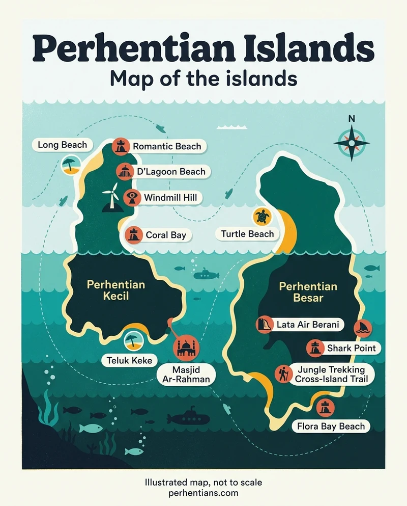
Perhentian Kecil has Long Beach, Coral Bay, Romantic Beach and D’Lagoon, and Windmill Hill is on the same island. Here’s what each place is good for:
- Long Beach (Pasir Panjang) is on the east coast of Perhentian Kecil and has the islands’ only nightlife1.
- Coral Bay, which Google Maps lists on Perhentian Kecil3, is the best place on the islands to watch the sunset1. It’s about ten minutes’ walk1 from Long Beach.
- Romantic Beach, also on Perhentian Kecil3, is one of the boatmen Mat & Man’s stops for photos and a rest4 on their trips.
- D’Lagoon is on the northern side of Perhentian Kecil5, at the end of the jungle path behind Bubu resort1. From there, a route leads on to Adam and Eve beach, on the west side, in about 25 minutes1.
- Windmill Hill is an observation deck on Perhentian Kecil3. Mimpi Perhentian’s package includes a windmill trek6.
- Masjid Ar-Rahman is a mosque on Perhentian Kecil3.
For what each beach suits and what it costs to stay there, see the Perhentian beaches guide. Still choosing an island? Read Perhentian Kecil or Besar.
Which beaches are on Perhentian Besar?
Perhentian Besar’s best and cleanest beaches are on its west side1. The checked places on Besar are Teluk Keke, Flora Bay Beach, Shark Point and a cross-island trail.
- Teluk Keke is a beach on Perhentian Besar3.
- Flora Bay Beach is on Perhentian Besar3. The resort of the same name sits on Teluk Dalam, a white sandy beach at the south tip of Perhentian Besar7.
- Shark Point is on Perhentian Besar3, and Teluk Dalam has a large beach near Shark Point1. Shark Point is also one of Besar’s popular snorkelling spots1.
- The Jungle Trekking Cross-Island Trail is a hiking trail Google Maps puts on Perhentian Besar, with opening hours of 07:00–19:00 every day3 (checked October 2026).
Snorkel spots around both islands
Shark Point turns up on most snorkelling trips, and the other stops change from boat to boat. These are the spots the operators name:
- Perhentian Besar’s popular spots: Teluk Pauh, Shark Point and Tanjung Basi1.
- The Barat’s Trip A: Shark Point, Teluk KK, Turtle Point and Turtle Beach8.
- The Besut Jetty day trip: Shark Point, Fish Point, Coral Garden, Turtle Point and Fisherman Village9.
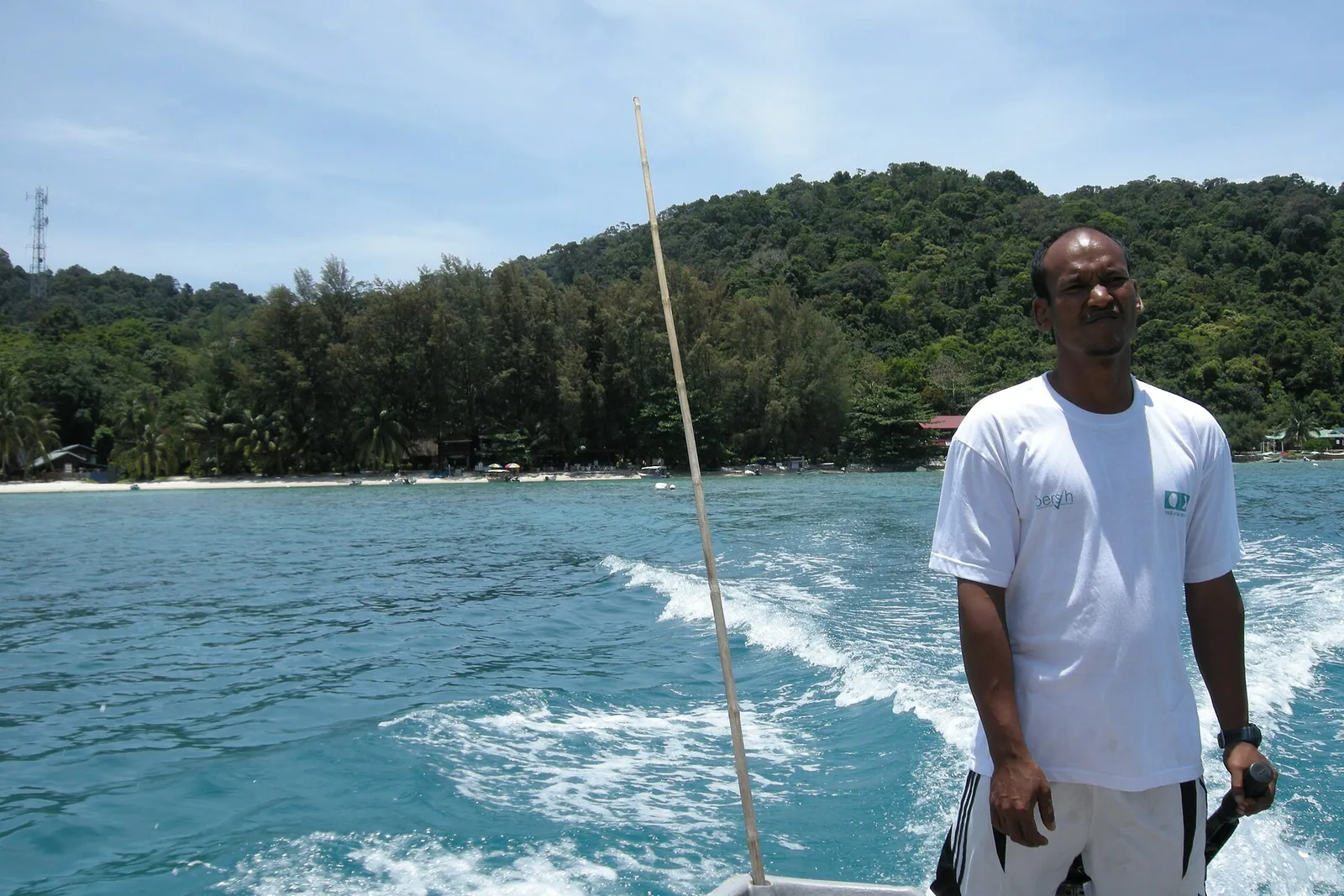
- Mat & Man’s long trip: stops that include Fisherman Village and Romantic Beach / KK Beach4.
Turtle Beach is on the map too, but its Google Maps address gives only Kuala Besut3, so go by its pin. The same goes for Rainforest Beach (Besut, Terengganu) and Lata Air Berani (South China Sea3).
Trip prices, dive sites and what’s included are on the Perhentian diving and snorkelling guide.
Getting to the islands
Speedboats from Kuala Besut take 30–45 minutes1 to the islands. Perhentian Trans runs boats every hour from 8 AM to 5 PM10.
Operators, fares and drop-off points are on the Kuala Besut ferry page. For the bus, flight and taxi to the jetty, see how to get to the Perhentian Islands.
Can you walk between the Perhentian beaches?
Yes, for many beaches: jungle trails link the beaches on both islands2. The walks on Perhentian Kecil are the easiest to plan:
- Long Beach to Coral Bay: about ten minutes1, and easy.
- Coral Bay to the fishing village: a paved trail, 30 minutes to Mira Beach, 20 more to Impiani beach and 20 more to the village1.
- Long Beach to D’Lagoon: take the jungle path behind Bubu resort1 at the north end of the beach.
Where there’s no trail, or it’s too hot to walk, take a water taxi. Fares are about RM12 for most hops, and negotiable1 (checked October 2026), so agree the price before you get in.
Photos: Wikimedia Commons. Authors and licences: image credits
Checked against 10 sources · last checked October 2026
- Wikivoyage · checked October 2026
- Wikipedia · checked October 2026
- Google Maps listings · checked October 2026
- Perhentian Private Snorkeling (operator) · checked October 2026
- perhentian-island.com (booking agent) · checked October 2026
- Mimpi Perhentian (resort) · checked October 2026
- Flora Bay Resort (resort) · checked October 2026
- The Barat Perhentian (resort) · checked October 2026
- besutjetty.com (booking agent) · checked October 2026
- Perhentian Trans (operator) · checked October 2026
Page history · last changed 19 October 2026
- First written